WHAT'S ON
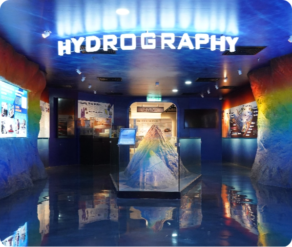
Hydrography
Did you know that Santubong Seamount located in the South China Sea, Sarawak? The shape and characteristic were obtained from hydrographic surveying multibeam system. It was discovered by our surveyors and mappers. Here in this gallery we bring to you the Santubong Seamount through a 3D model. Exploring hydrographic surveying through activities involving from water surface to the deep-down underneath, regardless of the surface of the sea, river or lake. Section in this segment are:
- Tidal Network
- Santubong Seamount
- Determination Of The Deepest Part Of The River Bed
- Surveyor Roles In Hydrography