WHAT'S ON
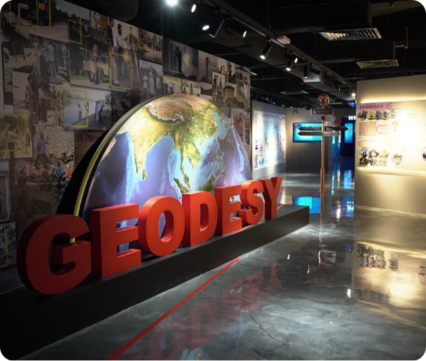
Geodesy
When you use map or GPS, have you ever wonder how it works? That’s geodesy at work. It helps to make maps, build bridges and even fly airplanes safely. Geodesy measures the earth accurately. It’s not only about measuring, Geodesy also helps us track movement. Earth is always on the move, with its tectonics plates shifting and changing. Geodesy also a guardian of our environment. It helps us monitor volcanoes, landslides and even changes in the sea level due to climate change. So, in a way, geodesists are like Earth’s doctors keeping a check on its health. Section in this segment are:
- What is Geodesy
- Evolution of Coordinate Reference system in Malaysia
- Malaysia Real Time Kinematic GNSS Network
- Malaysia GEOID Model Marine Geodetic infrastructure in Malaysia Water